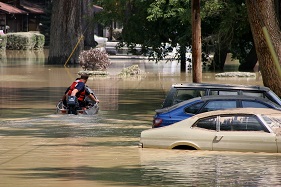
INRS develops a new flood risk analysis and management tool
Professors Karem Chokmani and Monique Bernier of INRS’s Eau Terre Environment Centre (and members of the Coonvergence Network) is developing GARI, a new flood risk analysis and management tool. The tool, a geographical information system (GIS) application, will consist of operational cartography and characterization modules for visualizing and analyzing flood risk in preparatory and operational mode.
Carried out in collaboration with Quebec and Canadian government partners, the project comes with nearly $1 million in funding over three years — $900,000 from the Canadian Safety and Security Program led by Defence Research and Development Canada’s Centre for Security Science, in partnership with Public Safety Canada. GARI will have significant implications for civil security by enabling more effective intervention before and during flooding.
For more information: INRS News.

